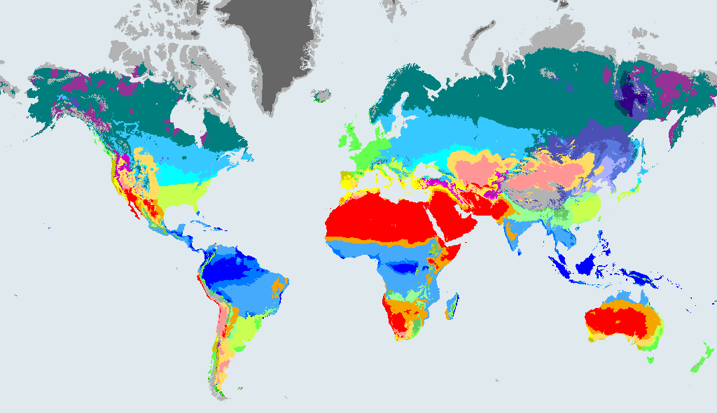
What a Dsb climate is like
Dsb Warm-summer continental with dry summer. A dry-summer climate with a freezing winter, mostly found at altitude in places that would otherwise be Mediterranean.
The rules behind the code, in plain English:
- Cold (coldest month at or below 0 °C).
- Dry summer: the driest summer month gets under 40 mm and under a third of the wettest winter month.
- Warm summer: the warmest month is under 22 °C, and at least four months are above 10 °C.
Dataset wording: "Cold, dry summer, warm summer". In the maps of Beck et al. (2023) the class is written: D: Not B and Thot > 10 and Tcold <= 0; s: Psdry < 40 and Psdry < Pwwet/3; b: Not a and Tmon10 >= 4.
Warm-summer continental climate with a dry summer has cold winters and warm, dry summers. Most of the precipitation falls in the cold half of the year, often as snow, and the summers are dry and sunny. Mountain forests of pine and fir are common, and water from the snowmelt feeds farms in the valleys below. People dress for hard frost in winter and strong sun in summer.
How much of the world is Dsb?
- 0.6%of the world's land outside Antarctica, 1991 to 2020
- 833,117 km²area, 1991 to 2020
- 43cities of 15,000 or more people (GeoNames) have this climate now
In 1901 to 1930 it covered 0.7% of that land, so its area then was 16.06% larger than in 1991 to 2020.
How the Dsb area is projected to change by 2071 to 2099
These figures compare the area of Dsb in each future map with 1991 to 2020. They come from the Beck et al. (2023) model projections under three emissions scenarios. They show what the scenarios imply, not what will happen.
| Map | Share of land | Change in area vs 1991 to 2020 |
|---|---|---|
| 1901 to 1930 (past) | 0.7% | +16.06% |
| 1991 to 2020 (now) | 0.6% | - |
| 2071 to 2099, SSP1-2.6 (low emissions) | 0.5% | -15.71% |
| 2071 to 2099, SSP2-4.5 (middle of the road) | 0.5% | -20.78% |
| 2071 to 2099, SSP5-8.5 (high emissions) | 0.5% | -18.02% |
Shares are of land outside Antarctica. A negative change means the zone shrinks.
What happens to today's Dsb land
Of the land that is Dsb in 1991 to 2020, this is how much stays Dsb and where the rest ends up in 2071 to 2099, by scenario:
| Scenario (2071 to 2099) | Stays Dsb | Where the rest goes (biggest first) |
|---|---|---|
| SSP1-2.6, low emissions | 60% | Dsa (20%), Csa (6.9%), Csb (6.6%), Dfb (3.8%), BSk (1.6%) |
| SSP2-4.5, middle of the road | 39% | Dsa (30%), Csa (16%), Csb (8%), BSk (3.8%), Dfb (2%) |
| SSP5-8.5, high emissions | 11% | Dsa (37%), Csa (34%), BSk (10%), Csb (5.8%), Dfb (0.7%) |
Looking back, 83% of today's Dsb land was also Dsb in 1901 to 1930. The rest was Dsc (9.7%), Dfb (4.6%), BSk (1.2%), Dfc (1.1%).
Where Dsb is found
The countries with the most Dsb land in 1991 to 2020:
| Country | Area | Share of all Dsb | Share of the country |
|---|---|---|---|
| United States | 291,326 km² | 35% | 3.1% |
| Turkey | 183,311 km² | 22% | 24% |
| Afghanistan | 142,228 km² | 17% | 22% |
| Iran | 79,628 km² | 9.6% | 4.9% |
| Kyrgyzstan | 24,681 km² | 3% | 12% |
| Tajikistan | 19,917 km² | 2.4% | 14% |
| Canada | 18,610 km² | 2.2% | 0.2% |
| Argentina | 14,451 km² | 1.7% | 0.5% |
Places with a Dsb climate today
The biggest cities in the 1991 to 2020 map that sit in Dsb (at most two per country):
- Anchorage, United States
- Sivas, Turkey
- Ağrı, Turkey
- Gardez, Afghanistan
- Meshgīn Shahr, Iran
- Flagstaff, United States
- Bāzār-e Yakāwlang, Afghanistan
- Khalkhāl, Iran
- Talas, Kyrgyzstan
- Thal, Pakistan
- Ishqoshim, Tajikistan
- Dalyoni Bolo, Tajikistan
Other cold (continental) climates (group D)
- Dsa Hot-summer continental with dry summer
- Dsc Subarctic with dry summer
- Dsd Subarctic with dry summer and very cold winter
- Dwa Hot-summer continental with dry winter
- Dwb Warm-summer continental with dry winter
- Dwc Subarctic with dry winter
- Dwd Subarctic with dry winter and very cold winter
- Dfa Hot-summer humid continental
- Dfb Warm-summer humid continental
- Dfc Subarctic (boreal)
- Dfd Subarctic with very cold winter
- All 30 zones
Frequently asked questions
What does Dsb mean in the Köppen climate classification?
Cold (coldest month at or below 0 °C). Dry summer: the driest summer month gets under 40 mm and under a third of the wettest winter month. Warm summer: the warmest month is under 22 °C, and at least four months are above 10 °C. The code is a short way of writing that: the first letter is the major group (D, cold (continental)) and the letters after it say more about rain and temperature.
What is a warm-summer continental with dry summer climate like?
Cold winters and warm, dry summers. A dry-summer climate with a freezing winter, mostly found at altitude in places that would otherwise be Mediterranean.
How much of the world has a Dsb climate?
0.6% of the world's land outside Antarctica was Dsb in 1991 to 2020, about 833,117 km² (Beck et al. 2023, 1 km maps).
Will the Dsb climate zone grow or shrink?
Under the middle-of-the-road scenario (SSP2-4.5), the area of Dsb in 2071 to 2099 is 20.78% smaller than in 1991 to 2020. This is a model projection, not a forecast, and it differs under other scenarios (see the table on this page).
Data: Beck et al. (2023), CC BY 4.0. See data sources and licences. Köppen-Geiger classes describe long-term averages, not weather.